|
|
Photo of the Week
September 30, 2007
|
|
|
The
Gatun that we all knew post Third Locks project is much smaller than the
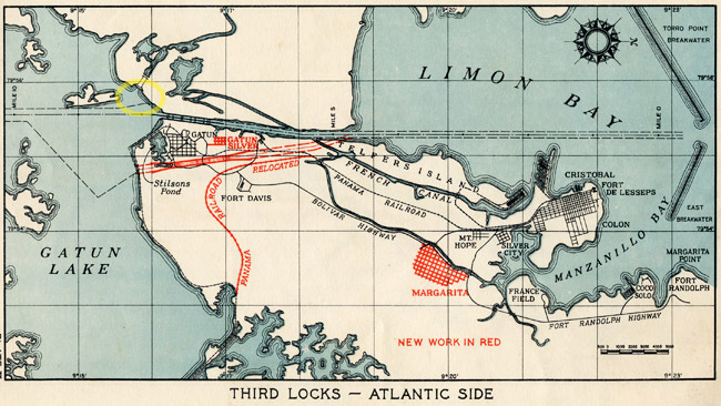
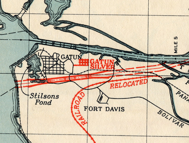
Gatun of yester-year. "Gatun was not always a brand-new village perched on the hill overlooking the valley. Says The Canal Record: "The old village of Gatun, which lay on the river flats below the present town was abandoned in 1908, and the site is now covered by 80 feet of rock and earth under Gatun Dam. At the time it was abandoned, the village contained a church, priest's house, school, a dozen small shops and ninety or more small houses of all descriptions from bamboo hut with palm thatch to the typical sheet iron roof shanty. Most of the buildings were moved to the new town site, now known as New Gatun. The railroad line also ran through the dam site and as soon as the present line into Gatun was opened, this likewise was abandoned, and the station building was razed. By the middle of 1909 the last vestiges of the old village had disappeared before the encroaching work on the dam." (See the yellow circle on the above map scan to see where the original town of Gatun was). (Also click here to see more information that was posted on CZ Images in 2001.) The area that I questioned last week as now being jungle was probably where the primary relocation of the old town of Gatun. The Gatun we all knew was constructed later. Above and below are scans of a priceless old map from The Third Locks Project - June 1914 informational booklet published by the Canal Zone Government with a forward by Governor Glen E. Edgerton. This is a great booklet with an explanation of the Third Locks Project of the 1940's and these great colorized maps. Written in the booklet is an explanation about the creation of the new towns needed for the construction of the Third Locks. Among these are Diablo Heights, Cocoli, on the Pacific and Margarita and a silver rate camp near Gatun. As written in the booklet: "Native tropical laborers (usually referred to as Silver employees) on the Atlantic side will be housed in a newly developed camp near the existing town of Gatun." The blown up map below clearly shows the same area as last week's wonderful aerial that captured these long forgotten town and camp. Compare the photo from last week and the map this week to see what those old buildings were. The color map also shows the relocation of the Panama Railroad once again and where the 1940 Third Locks were supposed to be. From what I understand, the Panama Canal Authority are following the 1940 plans and existing excavation for the new Third Locks Initiative in Panama today. This is great stuff in the long lost memories of the Golden Days of our Canal Zone history.
|
 |
Home|
Photo
of the Week | Photo
Archives | Main
Show Room | Photo
Room | Military
History
PC
History | Sign
Guest Book | Read
Guest Book | Search
CZ Images | CZ
Web Searcher
Gift
Shop | Book
Store | Links