 |
Photo of the Week
July 26, 2015
|
|
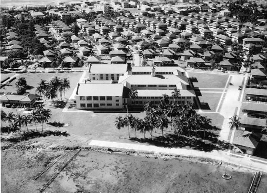
I posted a "today" photo of the same area which was almost taken at the same angle in 2006 (click here) Mini History Lesson: New
Cristóbal's construction progressed from 1917 to 1938, and involved
filling in swamp areas beyond Cristóbal which allowed the city of Colón
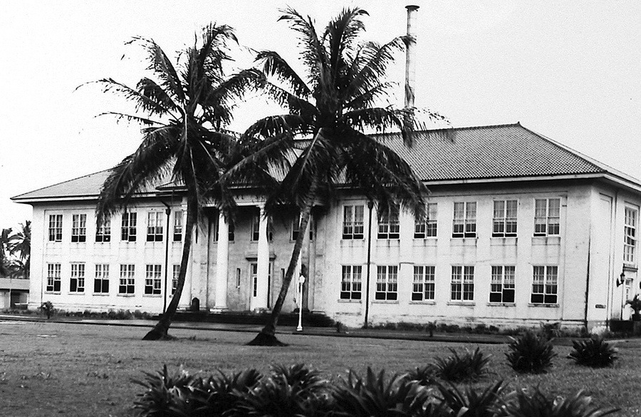
to expand too. As part of this expansion, a new Cristóbal elementary
school was built in 1918 and Cristobal High School in 1933. This period
coincided with the period of Colon's greatest economic prosperity.
During these years the port of Cristóbal employed almost 2,000
employees . The
mid-1950s saw the greatest transformation of Cristobal. This change saw
a drastic population shift of Cristobalites to new areas in Margarita
and Coco Solo, and the redefinition of territorial boundaries which
reduced the extension of the Canal Zone on Manzanillo Island. These
changes came about as a result of the construction of the town of
Margarita, the 1955 bilateral treaty, and the US Navy's transfer of its
Coco Solo Station to the Canal Zone government. Cristóbal's population
in 1955 dropped to 562, and New Cristóbal's to 1,130. Starting in late 1957, in compliance with the 1955 Treaty, five tracts of land totaling 48.5 acres in Cristóbal and all of New Cristóbal were transferred to the Republic of Panama. Cristóbal High School was moved from New Cristobal to Coco Solo, the Colon Hospital was moved from Colon Beach to an area south of Coco Solo and France Field, the Hotel Washington came under Panamanian jurisdiction, and the Panama Railroad stations in Cristóbal and Panama City were relocated. Many of the properties transferred as a result of the 1955 Treaty had been owned by the Panama Railroad for over 100 years. Photos
from the Panama Canal Museum / UF collection used in a display at the
Panama Canal Society Reunion in 2013.
|
 |
Home|
Photo
of the Week | Photo
Archives | Main
Show Room | Photo
Room | Military
History
PC History
| Gift
Shop | Links
