|
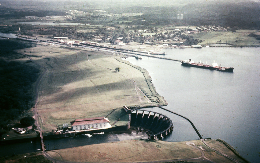
Another great aerial photo from the Panama Canal V. I. P. Slides and
dated 7-12-69 produced by the Panama Canal Graphics Branch. This
is another grand aerial of the Gatun area showing the Spillway, Locks,
the town of Gatun and Fort Davis in the distance. I posted another
aerial (click
here) back on November 9, 2014 showing the opposite shot from Fort
Davis towards Gatun Locks. This photo is really good showing the extent
of the Gatun earthen dam between the spillway and locks. Can you
imagine how much fill was used. The green area with its terraced
levels was used as a Golf Course in the early days. I wonder what
the zig zag formations are in the green area just above the dam. The old
Tarpon Club is seen in the lower left of the photo. I love how the
cloud shadows are projected in this photo. The greatest thing is
this photo is a capture in time when the Canal Zone was still the Canal
Zone.
I will post the rest of the
slides in the next few weeks to come. Only a few more.
|