|
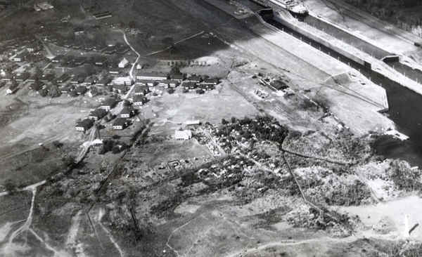
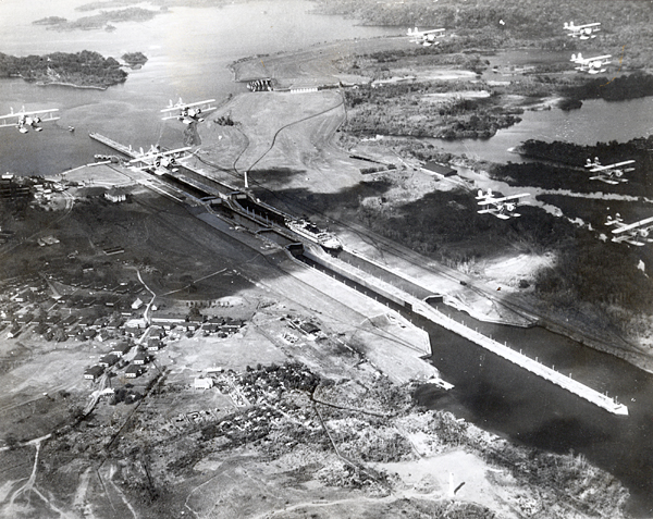
This week's photo is another real treat! This aerial photo was
taken by a Navy pilot while on patrol over the Gatun Locks. These
by-planes were stationed at Coco Solo Naval Base. The most
interesting thing about this photo is the buildings shown in an area
that is jungle today. When I lived in Gatun during the early '70s,
I was told there was a Local Rate or Silver town in the area where the
American Legion was. The white colored road going through the town
is either Lighthouse Road or School House Road. I have put a
zoomed in image below so you can the town better. When I zoom in
on my original scan, I see the houses are quite big (multi family), I see
a couple churches and what appears to be a club house in the middle of
town. There are some small houses in the wooded area off to the
right of the town with a small white church. I wish the photo
showed more of the town of Gatun. I also remember that there was a
cemetery in this area. I plan to go to Panama in February and will
check this area out some more. Anyone out there remember what this
town was called?
A
long lost memory of the Golden Day of our Canal Zone history.
|