 |
Photo of the Week
December 2, 2018
|
|
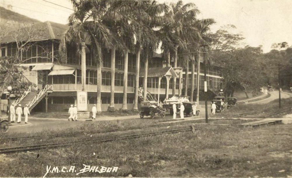
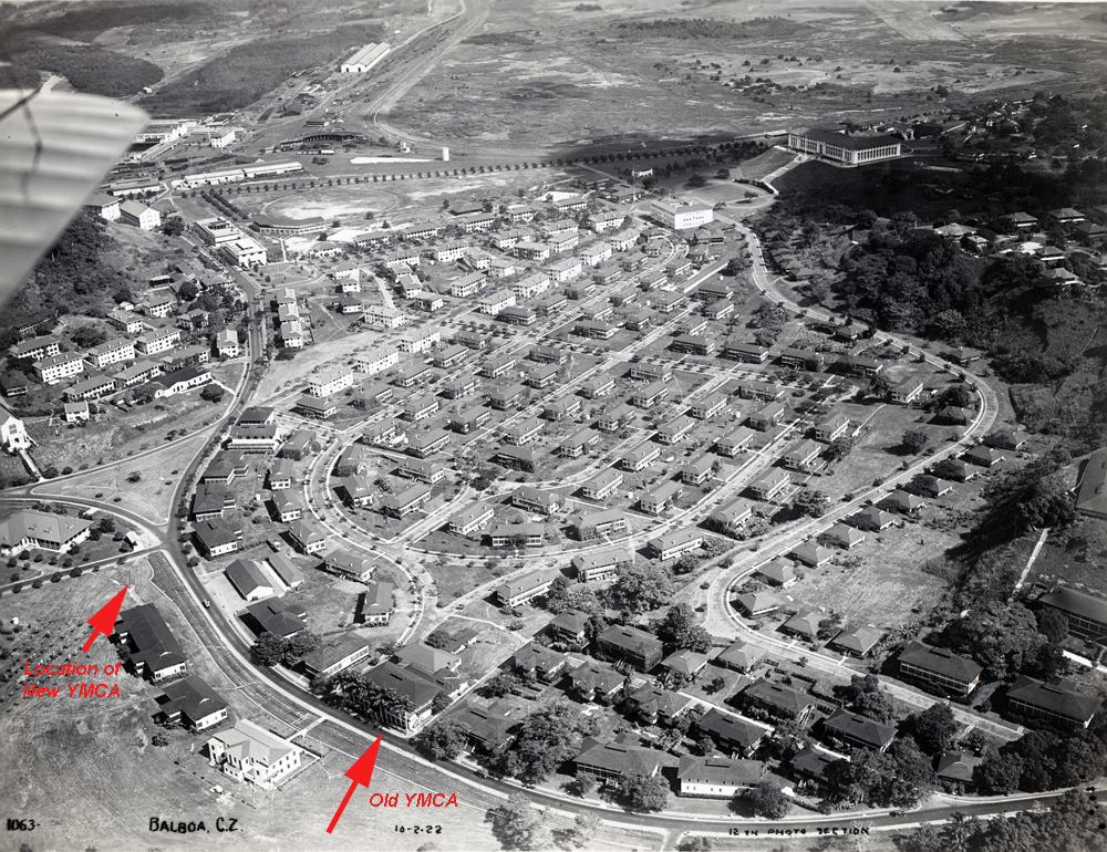
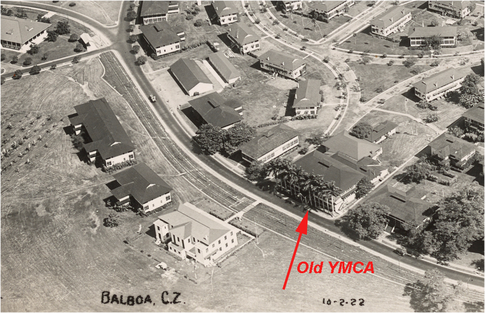
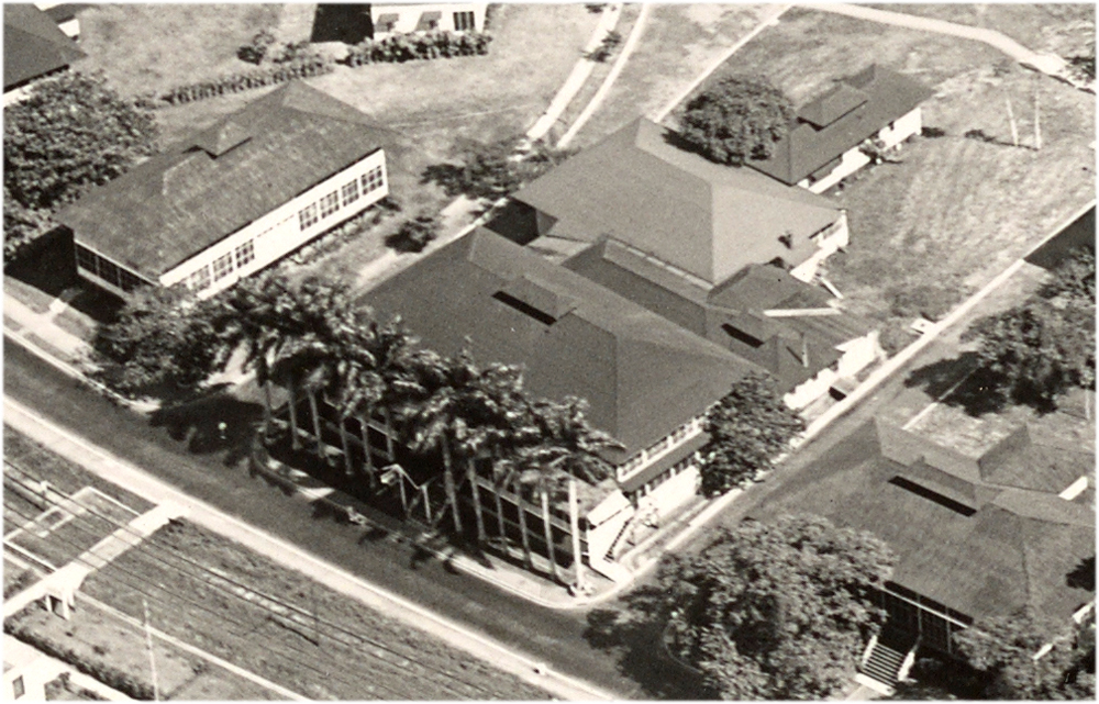
Puzzle solved!! Last week we had the photo of the old wooden YMCA in Balboa and it's location was a mystery. Well, thanks to input from CZ Images contributors Jim Norris and Richard Groom more clues were identified. The photo above was sent in by Richard Groom and is a SUPER shot. Upon studying it, I wondered what the road that went up the hill was and why were there railroad tracks shown in the grassy area? Then the building next store added more mystery, not to mention what looks like a hill behind the building. Where was this building? Well....I had forgotten about the 1922 aerial I had of Balboa I downloaded from the National Archives and with all the clues (especially the row of Royal Palms) location ID was easy on the old aerial. I have provided three images of this old 1922 aerial below. The first is an overall view of Balboa for visual orientation, the second and third are zoom in captures for a closer view of the building. The old YMCA is easily identified with the row of Royal Palms in front. The road mentioned earlier in the photo above is Balboa Road and the railroad tracks are not railroad tracks, but trolley car tracks. Note all the buildings to the rear of the main YMCA building which must have been auxiliary buildings such as a gym and other functional buildings. What looks like a hill behind the building in the above photo is some sort of anomaly as there is no hill behind the building except Ancon Hill in the distance and that is too far. I find it interesting that in when they built the new YMCA on the corner of Balboa Road and Amador Road, they planted a row of young Royal Palms which of course later grew up and most of us will remember those palms. I have noted with a red arrow the location of the new cement YMCA on the aerial directly below. I am in the process of digging through old Canal Records and Reports to the Governor to see if more information is available and will post next week. Also, I purchased the old colorized post card that Jim Norris found on the Internet and I will post it next week as it is still in the mail. It will put some color on the subject. I will also provide a study using a 1924 township map that shows all these buildings along Balboa Road and what took there place in later years. I sure am glad that the 1922 aerial photo was available to solve this mystery as there are not too many old timers around anymore that could say where the old YMCA was. Thanks for the help Jim and Richard.
|
 |
 |
 |
Home|
Photo
of the Week | Photo
Archives | Main
Show Room | Photo
Room | Military
History
PC History
| Gift
Shop | Links
