 |
|
|
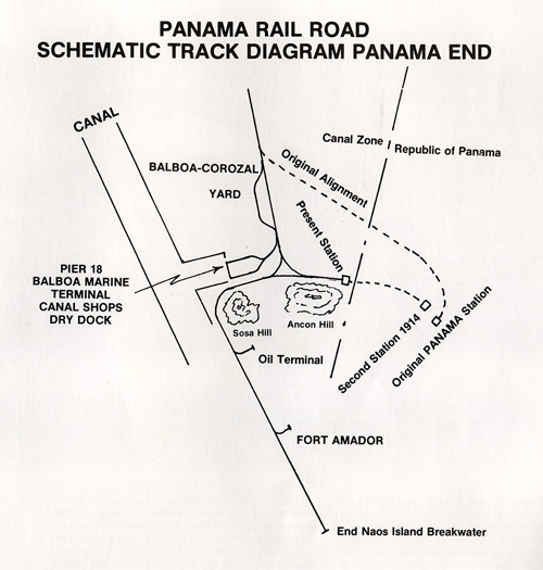
Diagram / Map showing
the Pacific / Panama end of the rails. I have included this
illustration to show how the old rail line went around Albrook
area. The dashed line shows the rail turned in the area of Diablo
Terrace to by-pass the Albrook swamp. This is shown in the 1928
aerial view photo in the Pacific section of this presentation. |
