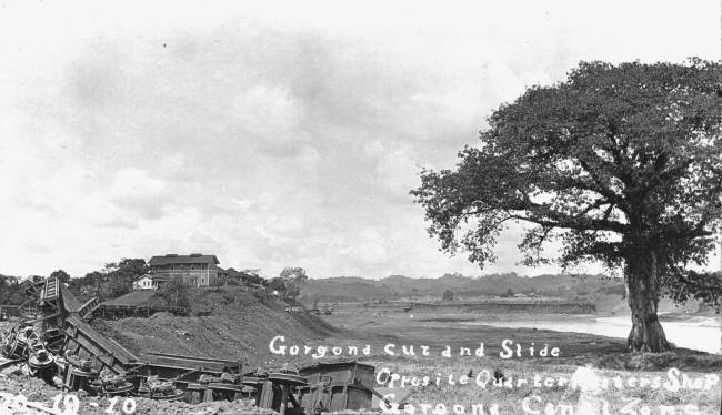
This photo is one of my
favorites. Gorgona has always been a special part of the Canal Zone's history.
Gorgona was around since the days of the Spanish explores and the Las Cruses Trail.
This photo is so very interesting to me as it shows the exact front bank of the Canal as I
know it being the slope in front of the buildings pictured. The present Canal's
water laps the top edge of the slop going up to the two story building shown. This
hill is now Gorgona Island. I can't figure the reason for the land slide in this
picture. There was some excavation in this area, but I can't figure this. You
can see the Chagres River on the right which is today's shipping channel. I read in
another reference that the very large and wonderful tree shown was blasted down at the
end. Otherwise, this tree would be in the West lane of the present
Canal. What a wonderful old picture. Gorgona Island is full of
ghosts....
|