
Panama
(pan'-uh-mah}
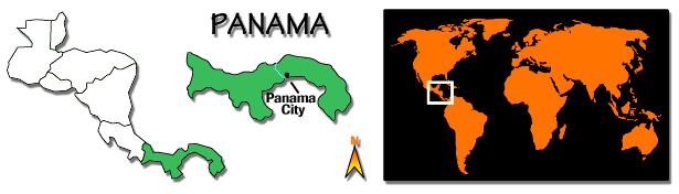
The Republic of Panama occupies the Isthmus of Panama, the 725-km-long (450-mi) neck of land that joins North America to South America. It is bounded on the north by the Caribbean Sea and on the south by the Pacific Ocean. To the west lies Costa Rica and to the east, Colombia. The PANAMA CANAL has been the dominant factor in the life of this former Spanish colony since it became independent from Colombia in 1903. Treaties negotiated between the United States and Panama in 1977 came into effect in 1979. They provided for eventual Panamanian control of the canal and for the virtual abolition of the PANAMA CANAL ZONE. Concerns for the security of the canal contributed to a December 1989 invasion of Panama by U.S. forces that ousted Panamanian strongman Manuel NORIEGA.
LAND AND PEOPLE
The dominant topographical feature of Panama is a low mountain chain that runs the length of the country. These central highlands are heavily forested and virtually uninhabited. The highest point in the region is Chiriqui Volcano (3,475 m/11,401 ft) near the western border. A wide belt of fertile volcanic soil lies along the Pacific side of the central highlands. This area of rolling plains is the leading agricultural region of the country.
Panama has a tropical climate, with high humidity and heavy rainfall. The annual precipitation varies from an average of 1,753 mm (69 in) on the Pacific side of the isthmus to 2,489 mm (98 in) on the Atlantic side. The climate is also affected by altitude. Average temperatures in the lowland farming areas along the Pacific coast are around 27 deg C (81 deg F).
The Chagres River, the most important of Panama's many short rivers, is formed by the confluence of two streams at Dos Bocas. By damming its waters at Gatun, the engineers of the Panama Canal Commission were able to form Gatun Lake, the central feature of the Panama Canal. Most of the country is covered with dense tropical forest, and animal life includes anteaters, armadillos, tapir, small tigers, and monkeys.
The country contains a number of distinct racial and ethnic groups. Its population is classified at 62% mestizo (mixed), 14% black, 10% white, and the remainder Indians and others. The most significant racial and cultural division is between the mestizo population and the blacks from Jamaica and Barbados, who were brought into the country to help construct the Panama Canal. The latter group, which constitutes under 10% of the population, speaks English rather than Spanish, the official language (although many Panamanians can speak English). Approximately 85% of all Panamanians adhere to Roman Catholicism, although blacks have largely retained their Protestant faith.
Approximately one-third of the country's population reside in the metropolitan area of PANAMA CITY, the capital and largest city. COLON, a major port and the Caribbean terminus of the Panama Canal, Portobelo, and David are also important.
ECONOMIC ACTIVITY
Since the completion of the Panama Canal in 1914, Panama's economy has been greatly influenced by this world transportation artery. The canal provides revenues and jobs; the dominant service industries function basically near the canal. Services include an important international finance and banking sector, which has helped, along with canal tolls, to compensate for Panama's chronic trade deficit. The cash crops include bananas, sugarcane, and coffee. Main food crops are rice, corn, and beans. Cannabis is illegally produced for the world drug trade. Industry is limited.
Panama has one of the highest per capita foreign debts in the world. The economy outside the service sector, which was increasingly based on legal but shady ventures allowing foreign companies to circumvent the laws of other countries, has been in decline since 1978. By some estimates, the economy contracted by 40% from 1987 to 1989 due to the imposition of U.S. sanctions, corruption, and the virtual collapse of the banking system. Unemployment rose dramatically, and the invasion itself caused further devastation. The release of Panamanian assets frozen by the United States and additional U.S. aid were unlikely to solve the overwhelming economic problems. The government sought to rebuild through a revival of the private sector rather than public works projects.
GOVERNMENT
Prior to constitutional reforms in 1983, the government was controlled by Gen. Omar TORRIJOS HERRERA, who seized power (1968) in a military coup. The Panama Defense Force (restructured as the Public Force in 1990) exerted a strong (even controlling) role under Torrijos and later under Gen. Manuel Antonio Noriega, although the nation has a civilian government headed by a president who is directly elected for a five-year term. Two elected vice-presidents and an appointed cabinet assist the president. Members of the unicameral Legislative Assembly are elected to five-year terms. Noriega annulled the May 1989 elections and dissolved the national assembly, but constitutional government was restored later that year with U.S. intervention
.
HISTORY
The first European known to have visited Panama was the Spaniard Rodrigo de Bastidas in 1501; in 1502, Christopher COLUMBUS explored the eastern Panamanian coast on his fourth trip to the New World. In 1513, Vasco Nunez de BALBOA crossed the isthmus and became the first European to sight the Pacific Ocean. Panama's early importance centered on its position as a transshipment route between Spain and its New World colonies. Panama was, as a result, one of Spain's wealthiest colonial centers during the 17th century. A Scottish attempt to establish a rival colony in the area (the Darien Scheme, 1698-99) was a disastrous failure.
Panama declared its independence from Spain in 1821 and joined Simon BOLIVAR's Gran Colombia. The economy lagged until the late 19th century, when interest in transportation schemes across the isthmus developed. In the 1880s a French company headed by Ferdinand de LESSEPS began to excavate a canal across the isthmus but later sold the rights to the United States. U.S. president Theodore ROOSEVELT supported a Panamanian independence movement, hoping a new government would grant the United States more favorable treaty terms for canal construction. These efforts led to a Panamanian revolt and declaration of independence from Colombia on Nov. 3, 1903. The new government immediately concluded the Hay-Bunau-Varilla Treaty with the United States, creating the U.S.-controlled Panama Canal Zone.
Much subsequent Panamanian history was dominated by the issue of whether the republic would someday gain sovereign control over the Canal Zone. None of the several modifications of the 1903 treaty negotiated between the U. S. and Panama satisfied Panamanian desire for complete control of the zone. In 1964, riots broke out between Panamanian students and U. S. citizens living in the zone. In 1977, U. S. president Jimmy Carter and General Torrijos Herrera released the texts of two new treaties (see PANAMA CANAL).
Gen. Torrijos had seized power in a 1968 military coup and was Panama's most powerful leader until his death in 1981. Aristides Royo, president from 1978 to 1982, was succeeded by Ricardo de la Espriella. Nicolas Ardito Barletta, president in 1984-85, was apparently forced out by defense strongman Noriega. His successor, Eric Arturo Delvalle, was ousted in 1988 by Noriega, who then installed Manuel Solis Palma as president.
The United States suspended aid and imposed economic sanctions in 1987 following anti-American demonstrations orchestrated by the government. Sanctions were intensified in 1988, after two U.S. courts indicted Noriega on drug charges, and again in 1989, after Noriega annulled elections held in May and installed Francisco Rodriguez as president. An Oct. 3, 1989 coup attempt failed, anti-American incidents increased, and U.S. forces invaded Panama on Dec. 20, 1989, and deposed Noriega. Guillermo ENDARA, generally viewed as the victor in the May election was installed as president. By April 1991, when Endara expelled all five Christian Democrats from his coalition cabinet, his government had come under attack for staffing the police with former members of the Panamanian army, failing to crack down on the drug traffic, money laundering (specifically through the BANK OF CREDIT AND COMMERCE INTERNATIONAL), and restricting press freedom.
Steve C. Ropp
Bibliography: Americas Group, Invasion: The American Destruction of the Noriega Regime in Panama (1990); Buckley, Kevin, Panama: The Whole Story (1991); Dinges, J., Our Man in Panama (1990); Farnsworth, David, and McKenney, James, U.S.-Panama Relations 1903-1978 (1983); Kempe, F., Divorcing the Dictator (1990); McCullough, David, The Path between the Seas (1977); Nyrop, R. F., ed., Panama: A Country Study, 3d ed. (1981); Priestly, G., Military Government and Popular Participation in Panama (1985).
TITLE: Panama
OFFICIAL NAME.
Republic of Panama
LAND.
Area: 77,082 sq km (29,762 sq mi).
Capital and largest city: Panama City (1989 est. pop.,
435,458).
Elevations: Highest--Chiriqui Volcano, 3,475 m (11,401 ft);
lowest--sea level, along the coast.
PEOPLE.
Population (1990 est.): 2,400,000.
Density: 31 persons per sq km (81 per sq mi).
Distribution (1987): 52% urban, 48% rural.
Annual growth (1989): 2.1%.
Official language: Spanish.
Major religion: Roman Catholicism.
ECONOMY.
GNP (1988 est.): $4.2 billion;
$1,830 per capita.
Labor distribution (1988): agriculture--30%;
public administration, defense, and services--29%;
trade--15%;
manufacturing--10%.
Foreign trade (1988 est.): imports--$700.5 million;
exports--$298 million;
principal trade partners--United
States, Mexico, Japan.
Currency. 1 balboa = 100 centesimos.
GOVERNMENT.
Type: republic.
Government leaders (1992): Guillermo Endara--president;
Ricardo Arias Calderon and Guillermo
Ford--vice presidents.
Legislature: Legislative Assembly.
Political subdivisions: 9 provinces, 1 territory.
EDUCATION AND HEALTH.
Literacy (1989): 90% of adult population.
Universities (1990): 3.
Hospital beds (1987): 7,798.
Physicians (1987): 2,722.
Life expectancy (1989): women--75;
men--71.
Infant mortality (1987): 23 per 1,000 live births.
COMMUNICATIONS.
Railroads (1988): 240 km (149 mi) total.
Roads (1987): 2,745 km (1,706 mi) paved;
5,785 km (3,595 mi) unpaved.
Major ports: 2.
Major airfields: 2.
Map Location[s]
Mexico, Guatemala, Belize, Honduras, El Salvador, Nicaragua, Costa Rica, Panama.
Almiranta, David, Puerto Armuelles, Punta Burica, Isla de Coiba, Santiago, Chitre, Punta Mala, La Chorrera, Colon, Panama, Isla del Rey, Punta Grande, La Palma, Tuira, Rio Chepo, Santa Marie.The Software Toolworks Multimedia Encyclopedia - 1992
Grolier Inc.